Bannau Brycheiniog
Although I’m fortunate to live only a few miles from the Brecon Beacons, I don’t think I’m alone in struggling to call the area by it’s new (old) name, Bannau Brycheiniog. I think to most visitors and very many locals it will always be the Brecon Beacons. I’m really not sure of the point of the change, it seems very inward looking when Wales should be striving to be less insular but I will resist getting political! I don’t see London reverting to it’s ancient saxon, pre Roman name any time soon.
Whatever you prefer to call it, there is no doubt it is an incredibly beautiful area that includes the highest peaks of southern Britain. I’ve spent many hours walking in all weathers and despite the gentle rolling hills and mountains, missing the craginess of its northern counterparts, it can be still a harsh and unforgiving place to be up high when the weather turns against you. People get into trouble all the time, especially on the Sunday jaunt up the highest peak in the south, Pen y Fan. No accident that this is where the SAS test their endurance and survival skills!
Aircraft Crashes
The potential for bad weather and low visibility is the main reason why there are a number of aircraft crash sites in the Brecon Beacons, especially from and around World War II. Flying had reached a peak of necessity for many aspects of the war effort; combat, bombing, logistics, troop transport, reconnaissance etc etc. Long before Sat Nav and many other electronic flying aids, navigation was still achieved largely by a compass, altimeter, dead reckoning and sight (that must be Sheffield, the trams are green) and many of the pilots had limited flying hours. Combine that with some 800m peaks and zero visibility and you can understand why things went wrong from time to time.
There are many walks you can do and there are quite a number of sites you can visit. Some of the sites are tricky to find due to being on boggy ground and well off the beaten track. At some of them, there is really not much to see. For example, there is the site of Spitfire X4588 that crashed about 5km south of Pen y Fan. There really isn’t much to see here, partly I think because it is relatively easy to access and many pieces of the wreckage have been taken. It is still quite moving to see the paque “Sgt Donald Perry Carruthers crashed Spitfire X4588, 23rd May 1942 aged 20. R100418 RCAF.”
The Walk
This loop takes in the sites of two WWII crash sites. The first is the site Wellington Bomber MF509 and the second de Havilland Vampire VZ106. You can park off the A4067 on Blaentwyni Road, which has become a sort of big laybay after being by-passed by the A4067. It’s just north of the Tafarn y Garreg pub. You then need to walk south down the A4067 to get to the start of the walk proper. Click the ‘Learn More’ link below to downlaod the GPX file.
Wellington Bomber MF509
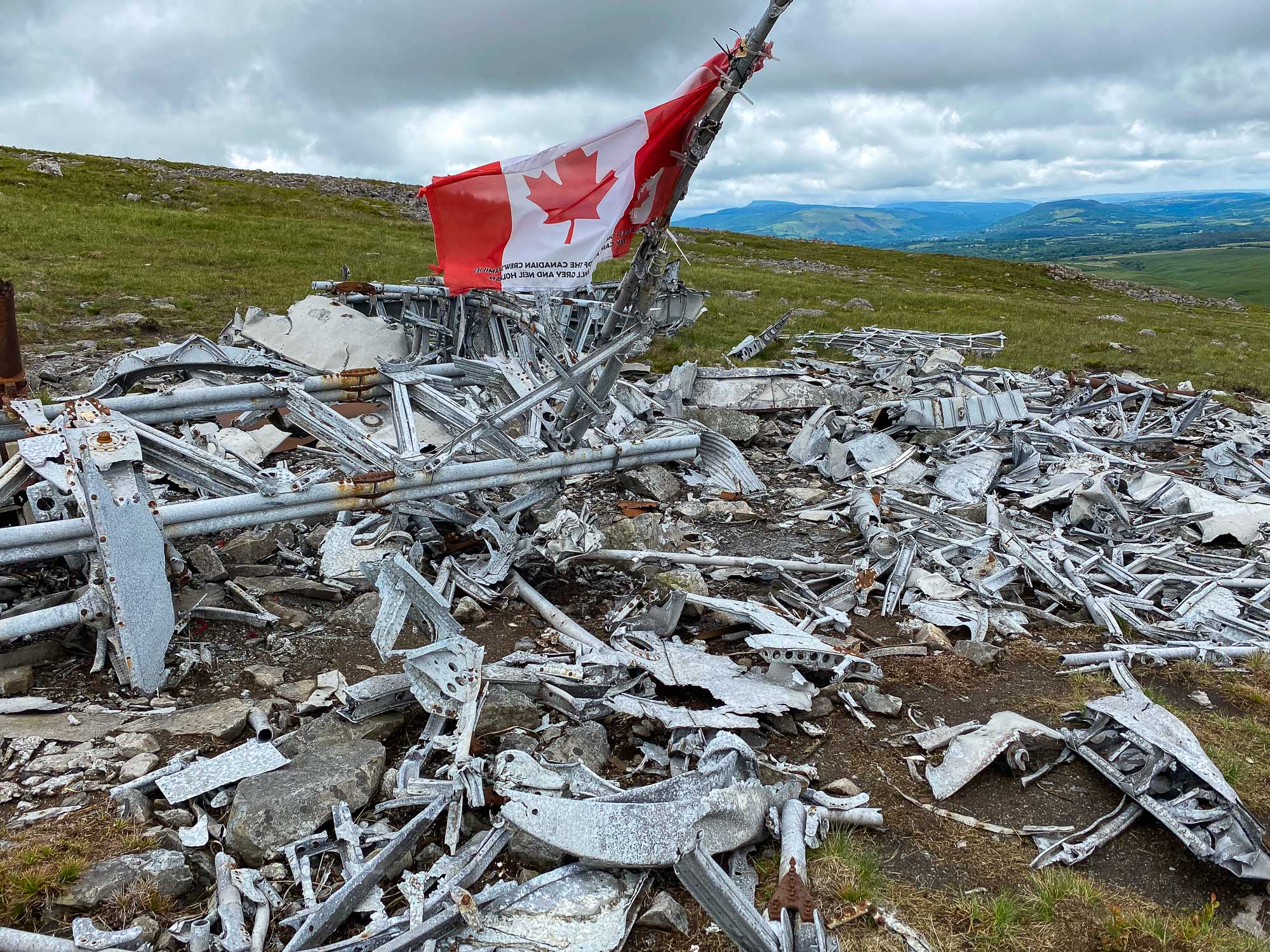
The Wellington crashed at Garreg Goch, in the western Beacons, (Grid Ref: SN817169). There is still a great deal of wreckage, some of it strewn quite a distance from the main site, indicating the magnitude of the impact. The Wellington came down on the night of 20th November 1944. It was from 22 Operational Training Unit, Wellesbourne, Mountford, on a cross country exercise and developed trouble in the starboard Hercules XVI engine. As it gained hight to clear the mountains it flew into shower clouds, building up heavy layers of ice on the wings. With insufficient power from the port engine, the aircraft lost height and crashed into Garreg Goch killing all six Canadian crew members.


It’s impossible not to be moved by the site of the wreckage, poppy wreaths and the canadian flag fluttering in the breeze. It is accompanied by two plaques – an older one listing the names of the dead and a more recent 2006 addition commemorating the unlikely visit of one of their surviving sisters, made possible only after much searching and cooperation between local people and authorities in Canada following the publication of a photograph originally found in the wreckage.
de Havilland Vampire VZ106
Also in the westerly Black Mountain region, and only 3-4km north-north-east of the Wellington bomber, sits the remains of a single seater De Havilland Vampire FB5. Brought into service at the war’s close in 1945, this particular plane crashed eight years later, on 9 October 1953, after mistakenly descending into the mountainside out of thick cloud. The single occupent, Pilot Officer J.R.B. Baldock, was killed. The wreckage has been arranged to some extent back into the shape of the aircraft.


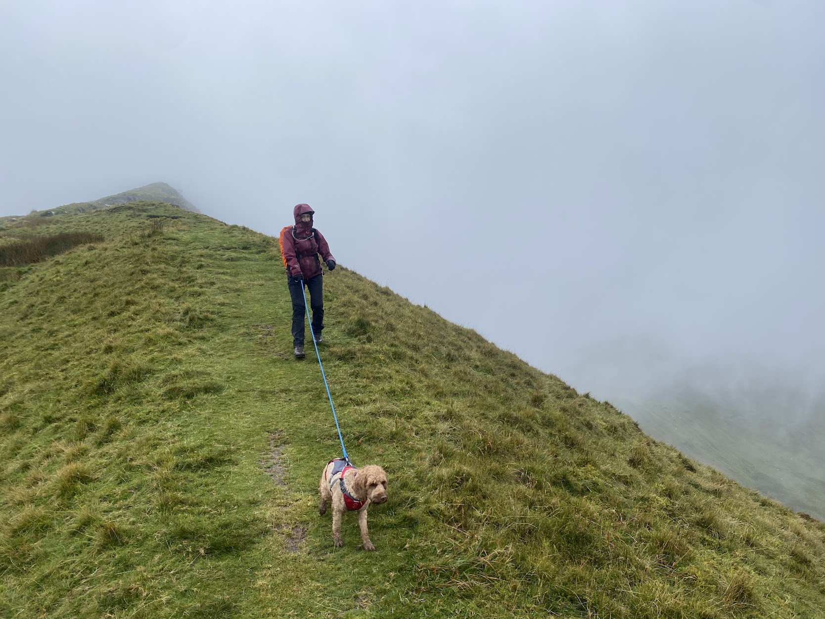
This one involves a bit more work, the location is pretty wild and the ground is rough but overcome it and you’ll find the wreckage at grid reference SN827201. Some care is needed heading across from the Wellington site with little in the way of defined route. The ground is very boggy at the best of times so you’ll need boots and to choose your route carefully. I ended up heading north up Cefn Rhudd on the west side of the gully, however you will need to cross the River Haffes at some point, so you will need to pick your spot depending on how much rain there has been. Either way, you are heading towards the saddle of Bwlch Giedd. In clear weather you’ll see the wreckage of the Vampire well before you get there.
The Way Back

There are a number of options you can take to get back to your starting point. The obvious one is back the way you came. Not my first choice! Other options involve heading for the saddle of Bwlch Giedd. There is quite a clear path from this point as this is the way most visitors to this crash site come from. From here you can go to the top of Fan Foel, at 802m the highest point in this area, just because. Then you have the option to either take the high road back along the Beacons Way route of Fan Hir. Cracking views on a good day down to Llyn y Fan Fawr and across to Corn Du and Pen y Fan. This route will bring you out at the camp site opposite the Tafarn y Garreg near where you parked the car.
Another option is to drop down from Bwlch Giedd to Llyn y Fan Fawr via the steep and rocky ‘staircase’ path. Great spot for lunch. Then you can take the low path SSE that runs parallel to the high route which also ends up at the same spot opposite the Tafarn y Garreg . This is the route in the GPX file linked above.
One other option from the lake is to walk SE on the north side of the Nant y Llyn river than drains from the lake. There is no path marked on the OS map but there is on the Open Street and Outdoor Active maps and, more importanty, there is indeed a path. This is a great route when there has been some rain as there are some beautiful waterfalls, not huge but very pretty. Just take care as they can catch you by surprise with some sheer drops as you approach from above. In fact this is a popular out and back route for people to just see the Vampire, go for a wild water swim in the lake, or just see the waterfalls.
This route takes you down to the small B road that comes off the A4067 where you parked the car. As well as finding a safe place to cross the River Tawe, you will need to complete the walk on the road back to where you started.
I hope you enjoy it as much as I did.